Accurate determination of coordinates is a cornerstone in various fields, such as mapping, geodetic research, and construction. A precision of up to 1 meter is fine for road navigation purposes, but some tasks such as construction or geodetic research require a much more precise error margin of no more than 1 cm. Achieving that level of accuracy solely using satellite signals is a challenge for fast-moving drones, and that is precisely why the development of Real Time Kinematic (RTK) technology is so important.
This technological advancement seeks to bridge this gap and provides reliable coordinates for fast moving drones and precision devices. In this case, it takes accuracy to the next level, by providing an incredibly precise determination of coordinates, thanks to the constellation of more than one satellite. Therefore, drones and other technology equipped with RTK have gotten an upgrade and are better prepared than ever for challenging tasks that demand high precision.
Table of Contents
How RTK Works
In typical navigation tasks, specialized chips are employed to process signals from satellites within range. The speed and accuracy of position determination depend on the number of satellites available. At least four satellites are required to precisely determine location.
Technically, a receiver measures the distance to each of the three satellites, and their intersections form a volume with specific dimensions. The size of this area affects coordinate accuracy—the more there are satellites. The smaller the intersection volume, resulting in diminished error.
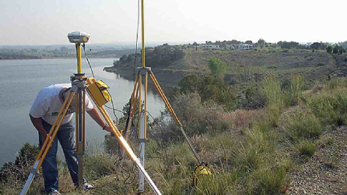
Ideally, for geodetic measurements, centimeter accuracy is required. Using stationary satellite receivers, this is achieved with relative reliability. But for mapping and researching large areas, this method is ineffective. In this case, unmanned aerial vehicles are used. When applying satellite navigation techniques for a flying drone. Moving in space at speeds up to 20 m/s, the complexity of position determination multiplies due to arising errors. To correct measurement errors in real time, RTK technology, or real-time kinematic, was developed. Besides a navigation chip in the drone, it involves using a stationary ground RTK base station
The ground station offers a clear advantage with its immobility, facilitating precise determination of coordinates. By working in tandem with the drone, it aids in accurate positioning, leveraging the reliable wireless communication channel between closely situated objects, minimizing interference.
What Affects the Accuracy of RTK
The accuracy of the RTK system is primarily influenced by the hardware and software components of the base station and a GNSS receiver on a drone. A higher computing power, quality antenna. And reliable communication protocol lead to a more stable and faster system response to emerging errors. It is important to note that the RTK working protocol is open. Allowing one base station to work with drones from different brands. However, it is advisable to ensure compatibility before making a purchase.
For those not wishing to set up a dedicated base station. Commercial base station networks can be accessed with subscription-based services. Despite this convenience, having a dedicated base station installed in the area of drone operation offers the best accuracy. In direct visibility, the communication range from the base station to the drone can stretch up to 100 km. External factors such as electrical wires, trees, and buildings interfere with this communication, notably impairing its stability. To bolster the reliability of the connection, operators are advised to reduce the physical distance between the base station and the drone.